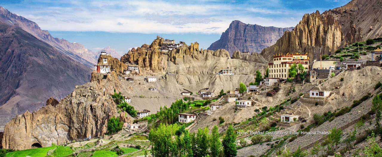
Himachal Pradesh
H imachal, which literally means mountain of snow – Hima=snow; Achala=mountain. Himachal, now knows as ‘the country’s orchard’, ‘nature’s paradise’ and ‘an abode of peace’, represented in ancient times the Himalayas itself, with Nepal, Koormachal, Kedar, Jalandhara and Kashmir as its five natural divisions. Himachal was also called Dev Bhoomi(the land of gods).
The earliest known inhabitants of the region were tribes called Dasas. Later, Aryans came and they assimilated in the tribes. In the later centuries, the hill chieftains accepted suzerainty of the Mauryan Empire, the Kaushans, the Guptas and Kanuaj rulers. During the Mughal period, the Rajas of the hill states made some mutually agreed arrangements which governed their relations. In the 19th century, Ranjit Singh annexed/subjugated many of the states. When the British came, they defeated Gorkhas and entered into treaties with some Rajas and annexed the kingdoms of others. The situation more or less remained unchanged till 1947. After Independence, 30 princely states of the area were united and Himachal Pradesh was formed on 15th April, 1948. With the recognition of Punjab on 1st November, 1966, certain areas belonging to it were also included in Himachal Pradesh. On 25th January, 1971, Himachal Pradesh was made a full-fledged State.
Himachal is situated in the heart of western Himalayas. The state is bordered by Jammu and Kashmir in the North, and Uttar Pradesh in the South-East. Haryana is in the South and Punjab is in the West and towards the north-east its boundary is contiguous with Tibet. Himachal is located between 30"22' and 30"12' north latitude and between 75"47' and 79"4' east longitude. It is a mountainous state with altitudes ranging from 350 to 7000 meters above the sea level. There are twelve districts in Himachal. Shimla, a beautiful city, is the state capital.
The region can be divided into following three zones:
1) Outer Himalaya or the Shiwaliks or the Southern Zone:
The southern zone consists of low hills of Shiwaliks (650m – 1500m) were known to ancient geographers as “Mainak Parbat”. Shiwaliks literally means “tresses of the Shiva”. They maintain almost a regular course from Ravi to Yamuna in the south of the region. Shivaliks have been highly deforested and eroded.
2) The Lesser Himalaya or the Central Zone:
The Lesser Himalaya is a region which consists of higher mountains (1500m-4500m) cut into by deep ravines and precipitous defiles. It is marked by ‘a gradual elevation towards the Dhauladhar and the Pir Panjal ranges. In the south the rise is more abrupt in the Shimla hills. To the south of Shimla is the high peak of Churdhar(3,647m). North of the Sutlej the rise is gradual.
3) The Great Himalaya and Zanskar or Northern Zone:
To the north of the Pir Panjal and Dhauladhar ranges are more lofty mountain-ranges, known as the Great Himalayas and Zanskar Range. They rise above the snow-line into peaks of perpetual snow. The Great Himalaya range (4500m-7000m) runs along the eastern boundary and is cut across by the defile of the Sutlej. The range separates the drainage of the Spiti from that of the Beas. The Zanskar range is the easternmost range and separates Spiti and Kinnaur from Tibet.
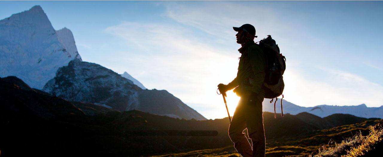
Himachal is a paradise for trekker, hiker, walker, mountaineers, climbers, skier and rafters etc.
General Information
State Capital : Shimla
Population (2001-cencus) : 60,77,248 persons
Area : 55,673 sq. km
Altitude : 350m – 7000m
State Language : Hindi & Local Dialects
State Animal : Snow Lepord
State Bird : Western Tragopan
State Flower : Rhododendron
Major Rivers : Sutlej, Beas, Ravi, Parbati and Chandra Bhaga
Major Lakes : Renuka, Rewalsar, Khajjiar, Dal, Beas Kund, Dasaur, Brighu, Prashar, Mani Mahesh, Chander Tal, Suraj Tal, Kareri, Sreolsar, Gobind Sagar, Nako
Major Peaks : Abi Gamin(7355m), Reo Purgil(6816m), Gya(6794m), Leo Purgial(6791m), Shingri Parvat(6645m), Parvati Parvat(6632m), Manirang(6597m)
MAIN PLACES OF HIMACHAL PRADESH
MAIN PLACES OF HIMACHAL PRADESH
- *Shimla
- *Manali/Kullu
- *Dharamshala/Kangra valley
- *Palampur
- *Sangla
- *Kalpa
- *Sarahan
- *Spiti Valley
- *Lahaul Valley
- *Mandi
- *Kasauli
- *Pragpur
- *Nalagarh
- *Chamba
- *Dalhousie
- *Hidden Himachal
SHIMLA
Shimla(“the queen of the hills”): Shimla derives its name from Goddess Shyamala, an incarnation of Goddess Kali, the deity of power and wrath. Shimla has been blessed with all the natural bounties, one can think of. Dwelling on a panoramic location, the hilly town is surrounded by green pastures and snow-capped peaks. Perched at an altitude of 2206 mts. above sea level, Shimla is located towards the southern parts of the north Indian state of Himachal Pradesh. It is the state capital and is at a distance of 378 km from Delhi, 260 km from Manali, and 118 km from Chandigarh.
The British discovered Shimla in the form of a little village in 1819 during the Anglo-Gorkha war. When war broke afresh in 1819, the British took the place with its cool and healthy climate. Here was installed a village of tents, where the heat weary British military and civil officers came to rest and the first house built in 1822, is regarded to be “Kennedy House” which was the residence of Charles Pratt Kennedy, the newly appointed political officer to the hill states. In 1864 under the Viceroyalty of John Lawrence, Shimla was officially declared the Summer Capital of British Empire in India (April to October). - a status is retained upto Indian Independence in 1947. After the independence of India, Shimla became the capital of Punjab until 1966, when it came under Himachal Pradesh. In 1971 Himachal Pradesh became a full fledged state and Shimla became the capital of this state.
Municipal Governance was introduced in 1851, piped water was available from the 1880s, and hydro electric power was available in early 20th century. One of the world’s early automatic telephone exchange began functioning in 1922. Shimla has the only natural ice-skating rink in India. An Ice-skating Carnival is arranged every year by the Ice-skating Club during January. In 1903 a rail line was constructed between Kalka and Shimla.
Shimla is surrounded by Seven Hills; as Prospect Hill, Summer Hill, Observatory Hill, Inverarm Hill, Bantony Hill, Jakhoo Hill, Elysium Hill. These hills offer a wide variety of trails to visitors to explore.
General Information
Nearest Airport : Jubbar Hatti 23 km
Nearest Railhead : Shimla
Road Distance : Kalka 92 Km, Chandigarh 118 Km, Ambala 170 Km, Delhi 378 Km, Manali 260 Km, Dharamshala 235 Km, Amritsar 345 Km
Best time to visit : Round the year
Sites to Visit
The Mall: The Mall is the main shopping centre of Shimla. It also has many restaurants, clubs, banks, bars etc. The Mall starts from Chhota Shimla to Viceregal Lodge, which is approximately five Km long stretch. This area has also been declared a 'Heritage Zone' by the State Government. The vehicles are not allowed into Mall road except ambulance and fire engines. Before 1947, only three carriages and later, cars were allowed into the town. These belonged to the viceroy, the Commander in Chief and the Governor of Punjab. The Mall in 1869 was an ordinary hill road used by pedestrians, horses, and wide enough for two horses to go abreast. In 1878, during the viceroyalty of Lord Lytton, Shimla roads were widened and expanded and made into a carriage-drive with the improved condition of the Mall, a long line of English type of shops came into existence and still there are many old beautiful buildings standing on Mall Road.
Gaiety Theatre: The Gaity theatre was built on Mall and opened on the 30th May 1887, Queen Victoria’s Jubilee year and since then plays have been staged in the Gaiety with unfailing regularity. Gaity designed by Henry Irwin, who designed the Viceregal Lodge.
Scandal Point: Scandal Point remains the hub of Shimla’s social life, the sensational name, originates from the story of a Maharaja who was banished from the boundaries of British Shimla for some unknown reasons. The Maharaja abducted a beautiful damsel Charles Allena, allegedly the daughter of the Viceroy, from this point in broad daylight and galloped away to his palace. It is the place where people gathered for both conversation and gossip. Now it is also known as the meeting place of the local Shimla.
The Ridge: This large open space in the heart of town presents excellent views of the mountain ranges, besides State library building and Christ Church.
Christ Church: The most prominent building on the Mall is the yellow Christ Church built in 1857, reputed to be the second oldest church in northern India. The Christ Church is the most important landmark here and is photographed by tourists. It was designed by Colonel JT Boileau in 1844, but consecrated only after 1857.
St. Micheal's Cathedral: This dressed - stone church with fine stained glass has a cruciform design and built in 1885.
State Museum: This building was a private residence of Lord William Beresford, the Military Secretary to the Viceroy for many years. After William left India, the General Sir Edwin Collan occupied it and then by Sir Edward Law the financial member of the Council after it served as residence of Indian government officials. In 1974 the government of India transferred this building into State Musuem. It houses a representative collection of Himachal Pradesh's rich heritage exhibits include archeological artifacts, carvings, paintings and sculptures. Closed on Monday and holidays.
Viceregal Lodge / Indian Institute of Advanced Study: The site for Viceregal Lodge was selected by Lord Lytton the Viceroy of India between 1876-1880. The plan suggested by Lord Dufferin and built in 1884-1888. He occupied it during the last few months of his stay in India. Henry Irwin was the architect of the building that resembles a Scottish baronial castle. This was the first building with electric light in Shimla. This was the venue of the Simla Conference in 1945. In 1947, the decision to partition India and East Pakistan (now Bangladesh), was taken here. After independence 1947, building became the property of the President of India and was renamed Rashtrapati Niwas but the second President of India Dr. Radha Krishnan transferred this property to the Indian Institute of Advance Study and some part is open to the visitor.
Jhaku Temple/ Hill (2455 Mts.): This is the town's highest peak and a vantage point for Shimla's famous views. The summit is crowned with a temple dedicated to monkey god Hanuman. This also offers a very good view of the snow capped mountains.
Prospect Hill/Kamna Devi(2125 mts.): Prospect Hill lies above Boileauganj and crowned by a temple dedicated to Kamna Devi, the Hill offers spectacular views of the area. This temple is 5 Km from Shimla, 10 - 15 minutes walk from Boileauganj.
Sankat Mochan (1975 mts.): This is a temple dedicated to Lord Hanuman. We get an excellent view of Shimla town from the temple. This is 7 km from main town.
Toy Train Ride: an unforgettable experience by toy train journey in the Himalayas Do not miss an unforgettable experience of the toy train journey if someone is in the queen of hills Shimla.
Adventure People India
offers a beautiful package for the sight seeing tour of Shimla’s surroundings, including the short toy train journey which starts from Shimla to Kandaghat and the time taken is 02 hours approximately to enjoy the stunning valleys, small picturesque villages and breathtaking views on the way.
The rail link between Kalka- Shimla built in 1903. It was laid under the guidance of Bhalku Sirmauri and built under the supervision of H.S. Harington Chief Engineer. The proposal of Kalka – Shimla railway line was prepared in November 1847. But it was only after opening the Broad Gauge Railway line from Delhi to Kalka on 3rd January 1891 that the construction of 96 Km. long railway line from Kalka to Shimla began. The 96 kilometer line, built on a 2 feet six inches gauge, was opened for traffic on 9th November 1903, during the Viceroyality of Lord Curzon and its "toy trains" still ply between Shimla - Kalka, passing through 103 tunnels (01 not in use), 800 Bridges and 900 Curves. Toy Trains, as per their names, are much smaller in size than the usual trains. Kalka - Shimla Toy Train has about seven coaches that can accommodate atleast 200 passengers in a single trip. Longest tunnel no. 33 is named after an Engineer Barog, who was in charge of construction of this tunnel. This tunnel is 1.1 Km long and remained the second longest tunnel on Indian Railways for a long time. The rail track rises from Kalka at 640 mts. to the Shimla at 2,060 mts.
In Guinness book of “Rail facts & Feats,” this Railway line has been described as “the Greatest Narrow Gauge Engineering feat in India”.
Excursions
Tara Devi (2100 mts.): Tara Devi is 23 Km by road from Shimla and crowned by a temple dedicated to the Goddess of the Stars/Tara Devi on top of a hill. Hundreads of people visit the Temple daily and whole view of the Shimla can be seen from the top.
Kufri (2501 mts.): This is 16 km from Shimla and has long been famous for its wide views, picnic spots, ski slopes and horse riding. The scenic beauty and panoramic views offered by Kufri are incomparable. On a clear day you can see the entire range of snow peaks. The Himalayan Nature Park/Zoo is also at Kufri where the Himalayan species of animals and birds can be seen such as Snow Lepord, Barking Dear, Wolves, Black bear, brown bear, Himalayan monal, Silver pheasant and red Jungle fowls etc. Fagu (2510 mts.):This is 22 km from Shimla and surrounded by apple orchards, small fields, villages and overlooking Giri Valley.
Naldehra (2044 mts.): Naldehra is 22 km from Shimla town and surrounded by beautiful deodar trees. This is a nine hole par 68 golf course. It was designed by the British Viceroy, Lord Curzon in 1903, who was so enchanted by the place that he even named a daughter after this spot, Alexandre Naldehra as her second name. The annual Sipi fair in June is held at Naldehra. It is a lovely, popular picnic spot and small walks through the thick forest of deodar can also be possible.
Chail (2226 mts.): 43 Km away from Shimla this was the summer capital of the Maharaja Bhupinder Singh of Patiala State and later Maharaja Yadevendra Singh, the last ruler of Patiala before independence. Chail Palace completed in 1891. It also has the world’s highest cricket ground at a height of 2444 mts. built in 1893.
Tattapani (656 mts.): This is 51 km from Shimla, located right banks of the river Sutlej and has hot sulphur springs those are known for curing skin diseases. Rafting is also possible at Tattapani in Sutluj river .
Narkanda(2708 mts.): Narkanda is situated 64 Km north of Shimla at an elevation of 2,708 m. about and is accessible through Theog and Matiana. The route goes through picturesque scenery from there is a splendid view of the snow peaked range of the Inner Himalayas. Hattu Peak is the highest peak in Narkanda at a height of 3,300 m and 08 km far from Narkanda. One finds a striking panorama of the plains below and the surrounding snow bastions on the sky line.
Manali - Kullu
Manali, one of India’s most famous hill stations, derives its name from Manu and Alaya, who came here for the renewal of the life after battling a deluge for forty days and nights. Manali (2050 mts.) is situated left bank of river Beas on the National Highway to Leh. This is the main town in the Kullu valley which is famous for its apples. Manali is also famous for adventure sports like trekking, mountaineering, paragliding skiing, hiking, mountain biking and rafting etc.
General Information
Nearest Airport : Bhuntar 50 km
Nearest Railhead : Shimla 260 km, Kalka 306 km, Pathankot(325 Km)
Road Distance : Mandi 107 Km, Shimla 260 km, Dharamshala 238 Km, Keylong 115 Km, Kaza 200 Km, Kalka 306 Km, Chandigarh 320 Km, Amritsar 436 Km, Leh 475 Km, Delhi 560 Km,
Best time to visit : May–July and September–November
Sites to Visit
Sites to Visit
Hadimba Temple/Doongri Temple: The temple is dedicated to the local deity Hadimba built in 1553 AD, and having four-tiered pagoda shaped roof and a front doorway carved with figures and symbols. Legend has it that the ruler who built this temple did not wish its carving to replicated, so he had the right hand of the artiest. It is believed that here Bhim, the great Pandava of the Mahabharata Epic killed the strong and cruel demon, Hadimb and married his sister Hadimba. Hadimba expurgated her all sins by performing a great Tapa, and consequently began to be worshipped as a goddess. A major festival is held here in the month of May.
Vashisth Hot Water Sulphur Spring: This is 3 km away from Manali and known for its pyramidal temple dedicated to Vashishta Muni, and natural hot water sulphur springs with two separate bathing tanks for gents and ladies.
Old Manali/Manu Temple: This is an original settlement with few old houses made of wood having slate roofs. There is also the Manu Maharishi Temple, dedicated to Manu, who was the creator of human race on the earth.
Monasteries: There are three new Tibetan monasteries at Manali, two are located in the town and one at Aleo on the left bank of Beas river. The famous Gadhan Thekchhokling Gompa built in 1969.
Solong Valley (2480 mts.): Solong valley is 13 km from Manali. This is a splendid valley between Manali and Kothi and offers the view of glaciers and snow capped mountains. There are good skiing slopes equipped with an excellent lift. The winter skiing festival is held here every year.
Excursions
Rohtang Pass (3979 mts.): Rohtang pass is 51 km from Manali on national highway to Leh and offers a panorama and spectacular Mountains view. This is a gateway to Lahaul Spiti, Pangi and Leh valley. The pass is officially open from June to October each year, although trekkers can cross it earlier. There are beautiful sights of glaciers, peaks and Chandra river flows down in the Lahaul valley.
Jagatsukh Village: This is one of the biggest villages in Kullu district and is 6 Km from Manali. The place is famous for its old temples of Shiva and Sandhya Gayatri in Shikhara style. It remained the ancient capital of Kullu.
Naggar(1840 mts.): Nagger is located at a distance of 18 km from Manali on the left bank of Beas river. Naggar was the capital of Kullu Rajas for about 1400 years and commands spectacular views of the valley. Naggar has a number of famous temples notably Vishnu, Tripura Sundari & Lord Krishana and a beautiful castle built by Raja Sidh Singh. The castle has now been turned into a hotel owned by HPTDC. The Roerich Art Gallery is close above the castle.
Kullu (1219 mts.): Kullu is situated 40 km from Manali on the right bank of Beas river and is well known for its colourful Dussehra, Raghunathji Temple, Devi Jagananathi Temple and Vaishno Devi Temple. The valley is also famous for its exquisitely woven colorful hand woven shawls and kullu caps. Fruit farming has become a major industry in the Kullu valley.
Basheshwar Mahadev Temple /Bajura(1097 mts.): This is 55 km away from Manali and 15 km from Kullu on National highway road and believed to have been built in the mid 8th century.
Manikaran (1737 mts.): Manikaran is 85 km from Manali and 45 Km from Kullu Town. This is situated on the right bank of Parvati river and famous for its hot water springs, Hindu and Sikh temples. Thousands of people take a holy dip in hot waters here. It is believed to be radioactive and good for such diseases as rheumatism, gout, and muscular pains. The water is so hot that dal, rice & vegetables can be cooked in it. According to legend a giant serpent stole Parvati’s earings while she was bathing with her consort Shiva. Shiva threatened Naga and he snorted the jewels out from under earth, which made holes and gave birth to hot waters.
DHARAMSHALA/KANGRA VALLEY
The Kangra valley is one of the most picturesque valleys of lower Himalayas. Dharamshala is a main town in Kangra valley and the headquarter of Kangra District, it lies on a spur of the Dhauladhar range and commands majestic views of the mighty Dhauladhar ranges above, and the Kangra Valley below. Dharamshala founded by British in 1855 and recognized as the headquarter of Kangra district. Dharamshala literally means ‘the Holy Refuge’ divided into upper and lower towns, lower Dharamshala is the main town at 1300 mts. and the upper Dharamshala or McLeod Ganj at 1770 mts. and is 10 Km away from the lower town. Mcleodganj gained new appeal with the arrival of His Holiness Dalai Lama in 1960. Today, it is known throughout the world as the Little Lhasa in India.
General Information
Nearest Railhead : Kangra 18 km, Pathankot 90 km
Road Distance : Palampur 34 Km, Mandi 126 Km, Amritsar 201 Km, Shimla 235 Km, Manali 238 Km, Chandigarh 252 Km, Delhi 515 Km
Best time to visit : September -June
Sites to Visit
Mcleod Ganj: Mcleodganj is a beautiful town on the top of Dharamshala, blessed equally nature and religion. Mcleodganj often called the ‘Little Lhasa’. This is the residence of His Holiness Dalai Lama, The Buddha temple is situated opposite to the present abode of His Holiness and it is the major centre for the studies of Tibetan culture.
St. John's Church: The church of St. John's in the wilderness lies on a motorable road between McLeod Ganj and Forsythe Ganj. It is a dressed stone church in whose courtyard lies the grave of Lord Elgin, one of the Viceroys of India who died at Dharamshala in 1863.
Bhagsunag Falls: At a distance of 2 km from upper town of Dharamshala, Bhagsunag can be approached by road; here an old temple, a fresh water spring, hotels and restaurants are located. Further about 2 km is beautiful Bhagsunag water fall which sooths one's eyes.
Dal Lake: The Lake is located next to the Tibetan Children's village 3 Km away from Mcleodganj. This is a small lake surrounded by Deodar trees.
Dharamkot: Dharamkot at an elevation of 2,708 mts. offers a panoramic view of the Kangra valley and the peaks of Dhauladhar.
War Memorial: This memorial is built near the entry point to Dharamshala to commemorate the post independence war heroes of Himachal Pradesh.
Norbulinka Institute: Just 13 km from Mcleodganj, Norbulinka was established to preserve and teach the ancient Tibetan arts. It named after a summer residence of Dalai Lama at Lhasa. Here one can watch the wooden carvings and the tangka paintings, golsithing and embroidery being done. There is a beautiful Buddha temple inside the institute.
Kangra Art Museum: It houses a representative collection of Himachal Pradesh's rich heritage exhibits include Kangra valley's arts, crafts, and rich past, displays artifacts that date back to the 5th century. The museum also includes a gallery of Kangra's famous miniature paintings and a representative collection of sculptures, pottery, and anthropological items.
Excursions
Chamunda Devi (1000 mts.): Temple is situated on the right bank of the Baner(also called Ban Ganga) stream, 15 km from Dharamshala. Durga Saptshati relates a story that Kalika, who sprang from the Forehead of Ambika(who had earlier emanated from the body of the Devi), cut off the head of Chand and Mund, who were sent by the demon generals. Shumbh and Nishumbh, to fight Ambika pleased at this, goddess Ambika blessed Kalika with a beautiful and shining figure and named her Chamunda, slayer of Chand and Mund. Chamunda was further given the boon to fulfill the desires of those persons who worshipped her. This place also has a beautiful bathing ghat and a small temple across the bridge joining the ghat.
Kangra Fort (770 mts.): The Kangra Fort situated at a 20 Km distance from Dharamsala. Kangra Fort was the seat of power of the Katcoch Rajas. It is said to have been founded by Susharma Chand Katoch, an ally of Kauravas in the Mahabharata period. The fort is situated on a strategic height, overlooking the Ban Ganga and Manjhi streams.
Shri Bajreshwari Devi Temple (768 mts.): Temple is situated in Kangra town 18 km from Dharamshala. Temple of Bajreshwari at Kangra is one of the most famous in Himachal Pradesh, Known once for its legendary wealth. Hearing the wealth of the temple Mehmood Ghazni plundered in the 11th century. It destroyed completely in 1905 by an earthquake and it was rebuilt in 1920. Thousand of persons visit the temple during the Navratra Fair.
Masroor Temple: Masroor is 15 km south of Kangra and 40 Km from Dharamshala. Known for its rock temples, there are 15 rock cut temples in Indo-Aryan style and richly carved built in 08th century and dedicated to Lord Ram, Laxman and Sita.
Jwalamukhi Temple(500 mts.): The Temple is 56 Km from Dharamshala dedicated to the goddess Jawalamukhi or "Goddess of Light", the temple is one of the most famous shrines. There is no idol of any kind the flame is considered as a manifestation of the goddess. Jawalamukhi is considered one of the 51 Mahashakti Pithas(holy places of Shakti) where the limbs of the burnt dead body of Sati(Consort of Lord Shiva) fell after being cut out by Lord Vishnu, who did so to save the earth from the wrath of Lord Shiva. It is believed that the tongue of Sati fell at Jawalamukhi and the flames coming out are regarded as the manifestation of the fallen tongue. Golden dome of the temple was a gift from the Emperor Akbar. Two important fairs are held here during the Navratras in April and mid October.
Pong Dam/Maharana Pratap Sarovar (500 mts.): Named in honor of the great patriot Maharana Pratap (1572-97 AD). Pong Dam or Maharana Pratap Sarovar is 115 km from Dharamsala. This reservoir was created in 1976 with the construction of Pong Dam on the Beas River. A total of 400 avian species have been recorded from Maharana Pratap Sagar wetland and the surrounding farmlands and hills. Thousand of migratory birds descend upon this water body each winter.
Chintpurni (975 mts.): 84 Km south of Dharamsala and 3 km from Bharwain on Dharamshala-Hoshiarpur road is the famous temple of Chintpurni on a ridge top. A stone idol (pindi) represents the goddess. According to the legend, hundreds of years ago a Brahmin, Maldas, saw in a dream a young girl with a lion listening to devotional music under a banyan tree. She told him that she was goddess Durga (Bhagwati) Chhinmastika -the headless form in which she killed Nishumukh, and, wanting to stay there, she asked him to build a temple for her and become its priest. She also told him that anybody who worshipped her with a pure heart would be relieved of all worries, hence the name Chintpurni. During Navratra days in March-April and September-October, a temple fair attracts thousand of pilgrims from all over the country.
Palampur: Is a popular hill station in Kangra Valley surrounded by tea gardens and pine trees, situated at a height of 1,220 mts. and 40 Km away from Dharamshala on the Dharamshala – Manali Road. Palampur founded by British tea planters and also known as the 'Tea Capital of North India, Palampur derived its name from ‘Pulum' meaning abundant water. This place is famous for its scenic beauty, historical temples and buildings built in the Colonial period. Behind this town stand high ranges of Dhauladhar Mountains.
General Information
Nearest Railhead : Palampur (Moranda) 4 km, Pathankot 115 Km
Road Distance : Dharamshala 34 Km, Mandi 92 Km, Amritsar 241 Km, Shimla 230 Km, Manali 200 Km, Chandigarh 250 Km, Delhi 545 Km
Best time to visit : September -July
Sites to Visit
Neugal Khad: Neugal Khad offers a fine view of the Dhauladhar range and close to the temple of Bundlamata, is this 300 mts. wide chasm, through which the Bundla stream flows.
Andretta: 13 km from Palampur, Andretta is a Home of the famous artist, Sobha Singh the great painter and artist and late Ms. Nora Richards, pioneer of rural theatre in India. There are beautiful paintings worth seeing in their private houses.
Baijnath: At a distance of 16 km from Palampur, Baijnath Temple is a pilgrimage centers of the Hindus and attracts people from all corners of India. The Temple built in 804 A.D dedicated to Lord Shiva. Close flows the Binwa Khund, considered sacred by local people.
Taragarh Palace: Taragarh Palace is situated 11 km away from Palampur at an altitude of 1000 mts. site developed in the early 1930s by the ruler of Bahawalpur, Nawab Sadiq Mohammed Khan Bahadur and later acquired by the royal family of Jammu and Kashmir. Palace has converted into hotel. It offers breathtaking view of the snow-capped peaks.
Excursions
Bir & Billing: 35 Km from Palampur above Baijnath is the ancient, picturesque village of Bir surrounded by tea gardens and oak forest. Open spaces serve as landing ground for Paragliders who take off from Billing. Bir has Buddhist Monasteries that are worth visiting. Billing, up in the hills 14 kms. from Bir is considered to be among the best sites in the world for paragliding.
Sangla Valley
Sangla valley, also known as Baspa Valley, is one of the most beautiful valley in Himachal Pradesh. It starts from Karchham where the Baspa river joins the Satluj. Sangla Valley has been named after a beautiful village Sangla, village is situated on the right bank of Baspa River 17 km from Karcham and National High way. The valley is thickly forested with tall deodars and the stately chilgoza(pine).
General Information
Nearest Railhead : Shimla 230 Km
Road Distance : Kalpa 51 Km, Sarahan 95 Km, Kaza 268 Km, Shimla 230 Km, Manali 320 Km, Chandigarh 350 Km
Best time to visit : April - November
Sites to Visit
Sangla Village(2680 mts.) : village is situated on the right bank of Baspa River, the village of Sangla has the main market and the village houses are an unique examples of wooded architecture.
Kamru Fort(2800 mts.): Fort is situated at a distance of 1 km from Sangla, it is a five storeyed old fort. It serves as an excellent example of an architectural style that is unique to this part of the world. The fort belonged to the rulers of erstwhile Bushehar.
Rakchham (2900 mts.): Rakchham village is situated on the right bank of river Baspa, 18 km away from Sangla. The village has some charming houses.
Chitkul (3450 mts.): Chitkul is the last and highest village in the enchanting Sangla valley, situated on the right bank of river Baspa at a distance of 26 km from Sangla. This is one of the most beautiful village in Himachal Pradesh. There are 3 temples of local goddess Mathi.
Kalpa
Kalpa (2759 mts.) is situated at a distance of 280 km from Shimla and 20 Km from Powari on Hindustan – Tibet Road, towards left side. Kalpa came into prominence when it was visited by the British Governor General, Lord Dalhousie (1848-1856 AD). Dalhousie was also responsible for the creation of the original Hindustan Tibet Road. There is beautiful temple of Narayan-Nagini which is a remarkable example of local craftsmanship and Hu-Bu-Lan-Kar monastery said to be have been founded by the Great Translator, Rinchensang-Po (950- 1055 AD). The village with its attractive temple, green fields, vineyards, apple, apricot and almond orchards makes an altogether lovely landscape. Kalpa has earned its name because of good quality Chilgoza, which grow in abundance. Kalpa faces the peaks of Raldang(5499 mts.), Jorkanden(6473 mts.) and the Kinner Kailash(6050 mts.) The Kinner Kailash is regarded as one the mythological abodes of Lord Shiva. This mountain changes colours several times a day with the changes of weather conditions.
General Information
Nearest Airport : Shimla 244 Km, Kullu(Bhuntar) 285 Km
Nearest Railhead : Shimla 269 Km
Road Distance : Sangla 51 Km, Sarahan 110 Km, Kaza 217 Km, Shimla 244 Km, Manali 310 Km, Chandigarh 365 Km
Best time to visit : April - November
Sites to Visit
Recong Peo (2670 mts.): Located 260 km from Shimla and 7 Km from Powari on the Hindustan-Tibet road, towards left side. Recong Peo is the district Headquarter of Kinnaur and is the main market or town. It offers a fine view of the Kinner Kailash.
Kothi (2700 mts.): Kothi also called Koshtampi. It is an ancient village only 2 km above Recong Peo. This village is famous for the temple of Goddess Shuwang Chandika. There is yet another temple dedicated to Bhairon.
Ribba (2745m): Another village Ribba is known for grapes.
Excursions
Morang (2591 mts.): This village is situated 39 km away from Kalpa on the left bank of river Satluj. This is an attractive village surrounded by apricot orchards. There is an ancient fort in the village, which is believed to have been built by Pandavas.
Nako (3662 mts.): located about 2 km above the Hangrang valley road and is 103 km from Kalpa, this is one of Kinnaur’s most fascinating villages. It has a lake surrounded by willow and popular trees. There are small but significant Buddhist temples and near Nako is a footprint – like impression ascribed to the Guru Padmasambhava.
Kinner Kailash Parikrama (6050 mts.): Mt. Kinner Kailash is considered a pilgrimage among the Hindus. ‘The Parikrama’ circumbulation around the base of the mountain is a 05 to 06 days. The parikrama begins from Thangi, 59 km from Kalpa and ends at Chitkul (3,450m) the highest village in the Sangla valley.
SARAHAN
Sarahan is situated at an altitude of 2165 mts. And about 176 km from Shimla and 17 Km from Jeori old Hindustan-Tibet road. This was the ancient capital of Rampur Bushehr, one of the biggest princely states in the Shimla hills and is well known for its centuries old Bhimakali Temple. A mixture of Hindu-Buddhist architecture, the Temple, a multi storey structure is very sacred to both Hindu and Buddhist. The ancient name of Sarahan was Sonitpur, where famous battle between Lord Krishna and Banasur had taken place. It provides a spectacular view of Shrikhand Mahadev (5227 mts.). Sarahan is surrounded by the fields, apple orchards, small villages and snow clad mountains, which make this a delightful are to visit.
General Information
Nearest Airport : Shimla 200 Km, Kullu(Bhuntar) 186 km
Nearest Railhead : Shimla 176 Km
Road Distance : Sangla 95 Km, Kalpa 110 Km, Kaza 327 Km, Shimla 176 Km, Manali 236 Km, Chandigarh 294 Km
Best time to visit : April - November
Sites to Visit
Bhimakali Temple: The Bhimakali temple is built in Indo-Tibetan architectural style, it is one of the finest examples of Himachali architecture and is dedicated to goddess Bhimakali. This is quite and ancient temple possibly dating back to the 7th-8th century A.D. This is revered as one of the fifty-one Shaktipeeths. In the Temple Complex are three more temples dedicated to Ragunath Singh, Narasingh and Lankra Vir. Lankra Vir Temple, also known as ‘Pataal Bhairav and there is a very deep well in this temple which was used by the rulers during an emergency.
Bird Park: Bird Park conserves rare high altitude birds like the Monal and Snow Coak. The Sarahan bird park has the world distinction of successfully having bred and reared the highly endangered pheasant species of ’Western Tragopan’ in captivity.
Excursions
Rampur (1005 mts.): Rampur is 40 km away from Sarahan and built by the banks of the river Satluj. It was the seat of the former princely state of Bushair. Rampur has plenty of Hindu and Buddhist temples, including the Raghunath, Ayodhya, Narasingh and Dumgir Buddha temples. The old Padam Palace is a remarkable piece of architecture built in 1925. Rampur was once a major stopover on the old trade routes. In the month of November, the Lavi Fair is organized here.
Gaura: About 37 Km from Sarahan lies the picturesque village of Gaura known for its apple orchards.
LAHAUL & SPITI
“Om Mani Padme Hum”
Lahul & Spiti is bounded by Ladakh to the north, Tibet to the east, and the Kullu valley to the south. Lahul & Spiti is largest district in the northern state of Himachal Pradesh. The district is named after its two subdivisions separated by high rising Kunzum pass(4551 mts.). The two rivers, Chandra and Bhaga which rise on either side of the Baralacha La, flow through the narrow Chandra and Bhaga valleys. Lahual & Spiti are known for their monasteries, which are great repositories of Buddhist faith and art treasures. The monasteries of Lahaul-Spiti are rich repositories of ancient murals, thankas, wood carving and golden images of Padmasambhava. Religion plays a major role in everyday life. “Om mane padme hum” is the sacred chant which literally means “O thou lotus in the jewel”. The repetition of the mantra “Om mane padme hum” is said to be bring good fortune and wash away all sins. There is no town in the district and entire population is rural. This district is also endowed with wide variety of rare animal species like Ibex, Snow Leopard, Musk Deer, Himalayan Fox, Himalayan Blue Sheep, and Himalayan Brown Bear etc.
Foreigners have only been allowed into this region since 1995. The altitude varies from over 6,500 mts. in the high peaks to 2,740 mts. There are two routes to enter Spiti. From Shimla via Kinnaur there is a motorable road which remains open upto Kaza for 8 to 9 months and second is from Manali which remains open from June to September.
Spiti is the sub division of Lahaul & Spiti district with its Headquarter at Kaza. It is called "Little Tibet" because it has almost the same terrain, vegetation & climate. Spiti also means "Middle Country”, the name given as a result of its ties both India and Tibet. The spiti has flat and broad valley bordered by vertical cliffs and the mountain ranges belongs to the Great and Middle Himalayas. Spiti River runs in the Spiti valley and is fed by glaciers and is a perennial one. Lingti and Pin rivers are left and right bank tributaries of the Spiti River. The there are some villages and fields in this valley and people grow barley, buck- wheat, peas & vegetables.the people are largely Buddhists and are followers of the Gelukpa sect. The people are simple and honest.
General Information
Nearest Airport : Kullu(Bhuntar) 250 Km, Shimla 444 Km,
Nearest Railhead : Shimla 421 Km
Road Distance : Keylong 187 Km, Manali 200 Km, Kalpa 217 Km, Sangla 268 Km, Shimla 421, Dharamshala 438 Km, Chandigarh 520 Km
Best time to visit : April - November
Sites to Visit
Kaza(3600 mts.) : Kaza is the sub-divisional headquarters of Spiti, situated on the left bank of river Spti on National Highway. This is the main market in the Spiti valley. It has all modern facilities and is connected by road with Manali & Shimla except in the winter months.
Ki Monastery(4116 mts.): It is situated 12 km north of Kaza above Ki village. It is the oldest and biggest monastery of the valley. This monastery is said to be founded by Dromoton (1008-64 AD). It houses beautiful scriptures and paintings of Budha and other goddesses. It belongs to Geluk-pa school and Tibetan Buddhism and has about 300 lamas in residence.
Kibber(4205 m): it is situated 18 Km from Kaza and 11 km above from Ki Monastery, locally known as Khyipur. This is the one of the highest villages in the world at an altitude of 4205 mts. There is also a Buddhist Gompa known as Yaktin Chuling. Gette village, at a short distance away from kaza, is the highest in the world with a height of 4270 m.
Excursions
Lalung Monastery: situated 22 Km from Kaza, village houses a small but somewhat unique monastery which is distinct for its heavily carved wooden Pennalling as for its seclusion.
Pin Valley / Kungri Monastery: The valley lies below the Kungri glacier. The Pin valley has a National Park, and is home to a variety of rare animals like the Ibex, Snow Lepord, Thar and Bharal. There are several monasteries in the valley but the most important one is Kungri. It is situated about 10 km from Attargo and 34 Km from Kaza. It built in 1330 AD. this houses old relics and painting and is the main centre of the Nyingma-pa sect in Spiti.
Dhankar Monastery(3890 mts.): It is located on top of a hill about 25 kms. east of Kaza and 7 Km from Schichling National Highway in local parlance, a ‘dhankar’ is a fort. This was once the castle of the rular Spiti, the Nano. On top of a hill there is a fort which uses to be the prison in olden times. Today it has about 150 lamas in residence, a collection of Buddhist scriptures, a 4 bodied " Vairochana" (Dhayan Budha) , murals of Medicine Buddhas and protector deities.
Tabo Monastery: It is situated 47 Km from Kaza and founded in 996 AD.by the great translator and teacher Rinchen Jangpo. It is a famous gompa next to Tholing Gompa in Tibet. The old section has 9 temples, 23 chorten, a monk’s chamber and a nun’s chamber. It has about 60 Lamas in residence. Wall paintings of this gompa have a great similarity to that of the Ajanta paintings- and are often called ‘Ajanta of the Himalaya’. There are natural caves aboves the monastery, which were an integral part of the 10th century monastic comp
Lahaul is part of Lahaul & Spiti district and Keylong is the headquarter of this district. The name Lahaul comes from Lho-yul meaning the south country. Lahual is also a fascinating area for Buddhist art and culture. The people of the area are religious, charming and friendly. Lahaul is nourished by the Chandra and Bhaga rivers and it is surrounded by high mountains on all sides. One of the hightest highways in the world passes through Lahaul and connects Manali with Leh. This crosses four high passes the Rohtang -La(3980 mts.), Baralacha- La(4892 mts.), Lachlang –La(5065 mts.) and Tanglang-La(5360 mts.). Lahaul also called a valley of glacier. Some of the famous glaciers are Bara Shingri, Chhota Shingri, Samundari glacier, Sonapani glacier, Gangstang and Perad glacier. Keylong is the main market in this valley.
General Information
Nearest Airport : Kullu(Bhuntar) 165 Km
Nearest Railhead : Shimla 375 Km, Kalka 421
Road Distance : Manali 115 Km, Kaza 187 Km, Mandi 222 Km, Dharamshala 353 Km, Shimla 375 Km, Leh 360 Km, Chandigarh 435 Km
Best time to visit : June - October
Sites to Visit
Keylong(3350 mts.): Keylong is located above Bhaga River, the district headquarters of Lahaul & Spiti and is the main market of Lahaul valley.
Kardang Monastery(3500 mts.): It is about 5 km from Keylong across Bhaga river.this is one of the most revered places of the Drug-pa sect. built in 12th century. It was renovated in 1912 by Lama Norbu. It has a large liberary, thangka painting, musical instruments and ancient weapons.
Guru Ghantal Monastery(3020 mts.): monastery is situated on the right bank of Chandra river 4 km above Tandi and 10 km from Keylong. It is believed to be the oldest Gompa of Lahaul and founded by Padmasambhava about 800 years ago.
Tayul Gompa (3900 mts.): Tayul means chosen place. It is 6 km from Keylong above the village of Stingri. It has 12 feet tall statue of Guru Padamsambhava and his two manifestations. Its liberary houses 101 volumes of the sacred Kangyur.
Shashur Monastery: located on a hill about 3 km from Keylong. Shahur means” in the blue pines”. Monastery is located among the blue pines. It belongs to red hat sect. It was founded in the 17th century AD by Lama Deva Gyatso of Zanskar. There are beautiful wall paintings and images in this monastery. During June/July Chham is celebrated in the monastery.
Gondla (3160 mts.): It is 18 km away from Keylong along the right bank of Chandra River. The village is surrounded by populars and willows. The residence of the Thakur of Gondla, called Gondla Castle or Fort is the main attraction. It is an eight storey building and built in 1700 A.D. by Raja Man Singh of Kullu.In the month of July a fair is held when Lamas dance & enjoy.
Excursions
Trilokinath Temple(2760 mts.): It is about 53 Km far from Keylong on the left bank of Chenab river. Trilokinath means the Shiva. This Shiva temple was given a look of Budhist shrine by Guru Padmasambhava by installing the 6 armed image of Avalokiteshvar. It is now sacred both to Hindus and Bhudhists. Every year in the month of August, Pauri festival is celebrated for three days.
Udaipur(2743 mts.): It is 53 Km away from Keylong near the confluence of Chenab and Mayar Nallah. Earlier this village was known as Margul and renamed by Raja Udai Singh of Chamba around 1695. It has an ancient temple dediocated to Mrikula Devi.This is also a popular pilgrimage centre for the both Buddhist and Hindu pilgrims.
Mandi
Mandi(800 mts.) is situated left bank of the river Beas. Mandi derives its name Mandi, or Market from the ladakh traders who passed through it, on their way to Hoshirpur. Mandi town was founded in 1527 AD by Raja Ajbar Sen. It is believed that rulers of Mandi and Suket had common ancestors who migrated from Bengal and set up Sen dynasty. Mandi known for its temples. In all there are about 81 temples. Mandi Shivratri held in February-March is the most popular festival of the region.
General Information
Nearest Airport : Kullu(Bhuntar) 59 Km
Nearest Railhead : Joginder Nagar 56 Km, Kalka 190 Km
Road Distance : Manali 107 Km, Palampur 92 Km, Dharamshala 126 Km, Shimla 143 Km, Manali 107 Km, Pathankot 213 Km, Chandigarh 203 Km, Delhi 450 Km
Best time to visit : Throughout the year
Sites to Visit
Buthnath Temple: Temple is dedicated to Lord Shiva. it is as old as the town itself and dates back to 1520 built by Raja Ajber Sen.
Trilokinath Temple: it houses a three faced idol of Lord Shiva symbolizing him as lord of three worlds. Built by Raja Ajbar Sen.
Panchvaktra Temple: it is situated on the opposite river bank to Trilokinath temple. It houses a five faced stone deity of Lord Shivaand facing it, is a life size sculptor of Nandi bull. The bull symbolically is considered Shiva’s vehicle. Syamakali Temple: it is located on a ridge of Tarna Devi hill towering above Mandi town. It was built by Raja Syama Sen in the 17th century.
Excursions
Rewalsar Lake(1350 mts.): The lake is 25 Km from Mandi town and it is one of the most picturesque natural lakes of Himachal Pradesh. Boating facilities are available. There are three Buddhist monasteries belong to the Nigmya Sect, a Sikh Gurdwara and three Hindu Temples dedicated to Lord Krishna, Lord Shiva and Rishi Lomas(Padmasabhava). There is also a mini zoo at Rewalsar.
It was from this place that the Sage Padmasambhava, a great teacher of Buddhism, left as a missionary to preach the doctrine of “The Enlightened” in Tibet. Guru Gobind Singh in his struggle with Mughal Empire in 1738 AD spent some time besided the holy lake. Gurudwara was built by the erstwhile ruler of Mandi, Raja Joginder Sen.
Prasher Lake(2730 mts.): it is 40 Km by road from Mandi and Lake can be reached in a day’s trek from Mandi. A three storied pagoda like temple besided the lake is dedicated to sage Prashar.
Kasauli
Kasauli (1927 mts.) is a charming quaint little town about 77 Km from Shimla, 35 Km from Kalka and 12 kms from the Shimla-Kalka road. It is developed by British and is an ideal place for those in search of peace and relaxtion. The town takes its name from the village of Kasul that has since merged with the fringes of the town. Kasauli is surrounded by a mixed forest of chir-pine, Himalyan oak and horse-chestnuts.
General Information
Nearest Airport : Chandigarh 61 Km
Nearest Railhead : Kalka 35 Km
Road Distance : Shimla 77 Km, Mandi 225 Km, Manali, Dharamshala 273 Km 341 Km, Palampur 92 Km, Chandigarh 61 Km, Delhi 325 Km
Best time to visit : Throughout the year
Sites to Visit
Monkey Point: This is the highest point in Kasauli but there are no monkeys here. It is 4 km from the Kasauli Bus stand and offers an excellent view of the distant plains of Chandigarh region, river Satluj and Chur Chandni. A small temple is also situated on the top of the hill, which is dedicated to Lord Hanuman.
The Christ Church: Still unspoiled and very much as the British left it fifty years ago, Kasauli has a fine old church. The Christ Church is a typically Anglican structure of the period and its foundation stone laid in 1844.
Sanawar: It is 6 Km from Kasauli and houses one of the best schools in the country. The Lawrence school is almost one hundred years old and a major attraction of the town.
Excursions
Sabathu: situated at an akltitude of 1737 mts and 28 Km away from Kasauli. A cantonment town which quartered British soliders at the time of British Empire, there is still a Gurkha fort which built in the early years of the 19th century when Shimla was a part of the empire of the kingdom of Nepal.
PRAGPUR
Paragpur (450 mts.) in the Kangra valley is one of the most panoramic areas in Himachal Pradesh. in December 1997 the Government of Himachal Pradesh notified Pragpur as a Heritage Village and followed this up by making Garli -Pragpur Heritage Zone in 2002. Said to have been founded in the early 17th century to commemorate Princess Parag Rani(a princess of the royal house of Jaswan), who revolted against the Muslim rulers of India, This was then to be Pragpur (named after the princess).
One of the important communities that settled at Garli - Pragpur and nearby hamlets were some of the 52 clans of the Sood Rajputs. Being enterprising, many made their fortunes at other destinations like Simla. At Pragpur and Garli, they built elegant havelis, mansions and Italianate buildings that are interspersed amongst lovely mud-plastered and slate-roofed houses which lie alongside streets paved with dressed cobbled stone. They also invested in schools, dharamshalas and water systems. In course of time, they settled where their economic interests lay.
Heritage Village Pragpur is ideal for Village land nature Tourism and is being promoted as an example of community involvement in tourism. The Indian National Trust for art and cultural Heritage jointly with the government of Himachal Pradesh is developing and preserving Heritage Village Pragpur.Sir Jai Lal's 300-year-old home has now been restored by his grandson, Vijai Lal. Though retaining the exterior of the ancestral home, he has used the original techniques but with modern plumbing and lighting. It has a very large bedroom, a kitchen, sitting room, dressing room and study with an open terrace overlooking the Dhauladhar peaks in the distance.
The Judge's Court: Built by Bhandari Ram for his son, Justice Sir Jai Lal. The building designed in the best Indo-European tradition was completed in 1918. The Building has now been converted into a heritage resort and appropriately named The Judge's Court as the property has traditionally been known as 'Judge Sahib Ki Kothi'.
It has two portions: -
-An ancestral cottage which is over 300 years old
-The Country Manor built by Bhandari Ram for his son, Justice Sir Jai Lal in 1918
General Information
Nearest Airport : Gaggal 45 Km,
Nearest Railhead : Pathankot 112 Km
Road Distance : Dharamshala 60, Palampur 85 Km, Mandi 177 Km, Shimla 191 Km, Manali 282 km, Amritsar 170 Km, Chandigarh 175 Km, Delhi 425 Km
Best time to visit : Throughout the year
Sites to Visit
Dada Siba /Chinor: It has an impressive, old Temple with beautiful Kangra murals on the inner walls. It is around 15 Km from Pragpur.
Jwalamukhi Temple(500 mts.): The Temple is 20 kms from Pragpur dedicated to the goddess Jawalamukhi or "Goddess of Light", the temple is one of the most famous shrines. There is no idol of any kind the flame is considered as a manifestation of the goddess. Jawalamukhi is considered one of the 51 Mahashakti Pithas (holi places of Shakti) where the limbs of the burnt dead body of Sati (Consort of Lord Shiva) fell after being cut out by Lord Vishnu, who did so to save the earth from the wrath of Lord Shiva. It is believed that the tounge of Sati fell at Jawalamukhi and the flames coming out are regarded as the manifestation of the fallen tounge. Golden dome of the temple was a gift from the Emperor Akbar. Two important fairs are held here during the Navratras in April and mid October.
Chintpurni (975 mts.): The Temple is 20 km from Pragpur. A stone idol (pindi) represents the goddess. According to the legend, hundreds of years ago a Brahmin, Maldas, saw in a dream a young girl with a lion listening to devotional music under a banyan tree. She told him that she was goddess Durga (Bhagwati) Chhinmastika -the headless form in which she killed Nishumukh, and, wanting to stay there, she asked him to build a temple for her and become its priest. She also told him that anybody who worshipped her with a pure heart would be relieved of all worries, hence the name Chintpurni. During Navratra days in March-April and September-October, a temple fair attracts thousand of pilgrims from all over the country.
Excursions
Haripur/Guler: it is 27 Km from Pragpur. Haripur, founded in 1464 AD is considered the cradle of the famous Kangra School of Paintings. The Fort at Haripur, ornamental tank and baolis (water springs) are also well worth the visit. The narrow gauge train station at Guler still employs equipment from the early 20th Century and to date, oil lamps light the signal at dusk.
NALAGARH
Nalagarh (870 mts.) is the gateway to Himachal Pradesh in North India. It is 300 Km north of Delhi and 60 Km from Chandigarh. Nalagarh was the capital of the kingdom of Hindur founded by Raja Ajai Chand in 1100 A.D. It was ruled by the Chandela Rajputs who originated from Chanderi in the Bundelkhand region of central India. The Chandela kings were great patrons of art and architecture. Raja Ram Chander, another illustrious ruler of the same dynasty, was also a great builder who constructed the Ramgarh Fort and the town of Ramshere. Raja Surendra Singh was the last ruler of Nalagarh and his son, Raja Vijayendra is the present ceremonial ruler of Nalagarh. This area witnessed some fierce fighting during the 'Gurkha Wars' in the first quarter of the 19th century.
Nalagarh Fort: The Fort is located on a hillock at the foothills of the mighty Himalayas affording a panoramic view of the Shivalik Hills beyond the Sirsa River. The Nalagarh Fort has a series of structures that are mostly built in the Mughal style of architecture. Fort was built during the reign of Raja Bikram Chand in 1421. Diwan-E-Khas at the fort(now the Confrence/Banquet Hall) was built by Raja Sansar Chand in 1618. Nalagarh Fort has undergone several renovations, and now functions as a premier heritage hotel.
General Information
Nearest Airport : Chandigarh 60 Km,
Nearest Railhead : Kalka 42 Km, Chandigarh 60 Km
Road Distance : Kasauli 77 Km, Shimla 135 Km, Dharamshala 192 Km, Mandi 145 Km, Chandigarh 60, Delhi 300 Km
Best time to visit : Throughout the year
Sites to Visit
Ramgarh Fort: An excellent excursion from Nalagarh is to the impressive Ramgarh Fort. Built by Raja Ram Chander in 1540, the Fort is situated at a height of 4000 feet. The Fort is located 21 Km north of Nalagarh. The Fort commands a breathtaking view of the plains and towns of Punjab, and snowclad peaks of the Himalayas.
Ramgarh is an important landmark of the famous Gurkha Wars of the mid nineteenth century.
Excursions
Mughal Gardens: The famous Mughal Gardens at Pinjore are only 35 km away.
CHAMBA
The town of Chamba (1000 mts.), the district headquarter of Chamba district is situated on the right bank of the Ravi river valley between Dhauladhar and Zanskar ranges south of the inner Himalayas. Town founded by Raja Sahil Varman in 920 AD when he conquered the lower Rani valley from the petty chiefs called Ranas and Thakurs. Chamba offer a variety of Scenic beauty. It has preserved the ancient cultural heritage and civilization.There are several old temples and places, some dating back a thousand years.most prominent and revered among these are the Lakshmi Narayan temple, Champavati temple, Vajeshwari Devi Temple, Hari Rai temple and Chamunda Devi temple and other attractions are Chaughan and Bhuri Singh Musuem.
General Information
Nearest Airport : Gaggal 140 Km, Amritsar 189 Km
Nearest Railhead : Pathankot 118 Km
Road Distance : Dalhousie 41 Km, Dharamshala 169 Km, Shimla 378 Km, Mandi 312 Km, Manali 401 Km
Best time to visit : April - October
Sites to Visit
Chaugan: This grassy lawn less than one Km in length and about seventy five meters wide is the focus of Chamba’s cultural activities. In 1890s the leveling of the Chaugan was done. It became a public promenade and Cricket ground for the British. A week long Minjar Fair, held in July-August display the regions traditional gala dresses, song, dance and music. Minjar is the most popular fair of Chamba which is attended by a large number of people from every corner of the district.
Laxmi Narayan Temple: Temple was built by Sahil Varman in the 10th century AD. There are six shikhra style temples within the complex, the main temple dedicated to Lord Vishnu.
Bhuri Singh Musuem: Musuem named after Raja Bhuri Singh who ruled Chamba from 1904 to 1919. He donated his family collection of paintings to the museum. It houses a fine collection of miniature paintings from Kangra, Basholi, Chamba and other Pahari schools.
Chamunda Devi Temple: Three Km away from Chamba this is an ancient temple and provides a panoramic view of Chamba. Behind the main temple is a small shrine of Lord Shiva in the Shikhara style.
Champavati Temple: This shikhara type temple built by Raja Sahil Varman in memory of his daughter Champavati who is worshipped as a goddess in Chamba.
Vajreshwari Temple: It is believed to be 1000 years old and dedicated to Devi Vajreshwari-Goddess of lightning.
Hari Rai Temple: Artistic excellence of this Lord Vishnu temple at Chaugan’s gate dates back to 11th century. It was built by Salabahana.
Rang Mahal: One of the largest monuments, The foundation of Rang Mahal was laid by Raja Umed Sing (1748-1764). Rang Mahel is a palace with a blend of British colonial architectural styles. It has superb wall paintings.
St. Andrew’s Church: This is more than 100 years old. A dressed-stone structure with lance windows.
Excursions
Bharmaur(2130 mts.) : it is 65 Km from Chambait remained capital of the Chamba state for over 400 years till 920 AD., when a new capital was founded at Chamba by Raja Sahil Varman. Bharmour possesses ancient temples built in 8th, 9th and 10th centuries. Built in Shikhara style. Temple complex at Bharmour is known as Chaurasi, meaning 84 temples. Legend says that 84 saints came to Bharmour during the region of Raja Sahil Verman and meditated in Bharmaur over 1000 years ago. Due to this the temple complex came to be called Chaurasi.
Famous holy trek to the sacred lake of Manimajhesh (4183) starts from Bharmour.
Dalhousie(2036 mts.) is a quiet and delightful summer destination in Himachal Pradesh. The hill station is located around 5 hills(Kathlog, Potreys, Tehra, Bakrota & Balun, heights ranging between 1525 mts. to 2378 mts.) on the Dhauladhar mountains,covering an area of 14 sq.km, just east of the Ravi River. This colonial town was established in 1854 by the British Governor General Lord Dalhousie. The town presents magnificent view of Chamba valley and the Dhauladhar range.
General Information
Nearest Airport : Pathankot 90 Km, Gaggal (Kangra) 114 Km
Nearest Railhead : Pathankot 90 Km
Road Distance : Chamba 43 Km, Dharamshala 127 Km, Shimla 335, Manali 360, Amritsar 201 Km, Chandigarh 300 Km, Delhi 485 Km
Best time to visit : Throughout the year
Sites to Visit
Subhash Baoli (2085 mts.): 1.5 Km from GPO, commands a view of snow capped mountains. It is served as the great Subhash Chandra Bose's retreat. Neta ji Subhash Chander Bose during his 7 months sojourn in Dalhousie in 1937 is believed to have spent most of his days by the side of this water body.
Satdhara (2036 mts.) : situated at a distance of 2 Km from the town, there are seven springs of Satdhara, known for their medicinal properties.
Panchpula (Five Bridges): Just 3 Km from the town, it is a pretty spot, whre the water of a natural tank flows under five bridges. There is an elegant monument erected at Panchpula dedicated to the great freedom fighter, Bhagat Singh's uncle, Sardar Ajit Singh, who breathed his last in Panchpula.
Bakrota Hills (2085 mts.) : located at a distance of 5 Km from the town. It is a popular walking circuit around these hills has a spectacular view of the mountains.
Churches: Dalhousie has four of them. St. John’s church at Gandhi Chowk is the oldest built in 1863 situated at a distance of 2 Km from bus stand.
St. Francis’ church is a very prominent monument on the Subhash Chowk built in 1894,
St. Andrew’s commonly known as the Church of Scotland was built in 1903 at Baloon by Protestant Christians. It is one and half Km from bus stand.
St. Patrick’s Church is situated in Baloon, approximately 2 Km from bus stand. This is largest church in Dalhousie built in 1909.
Kalatop: (2440 mts.) : 10 Km away from Dalhousie town. It is one of the most beautiful areas for picnic.. The Kalatop wildlife sanctuary area is the habitat of a variety of fauna including the leopard, black bear, goral, barking dear monal and koklas pheasant.
Excursions
Khajiar (1960 mts.): just 23 kms from Dalhousie, the beautiful little plain of Khajiar is one of the favourite retrete for visitor. Once famous as royal retrete for golfer and polo player, it was named the Switzerland of Himachal Pradesh by Mr. Willy t. Blazer, Vice Counselor and Head of Chancery of Switzerland in India in 1992, becoming the 160th tourist spot in the world to be christened mini-Switzerland. There is a small lake in the center of the saucer shaped meadow which has in it a floating island. A little away from the lake is the temple of Khajji Nag belonging to 12th century. The snake god Khajji Nag is worshiped in a human form. Five life size wooden statues signify presence of Pandava from the epic age of Mahabharata. The town has many beautiful walks and landscape is picturesque.
Hidden Himachal
Renuka
Renuka Ji (660 m) lies in the low Shiwalik hills it is about 45 Km from Nahan. Renuka Lake is one of the most beautiful lakes in Himachal Pradesh. The Renuka Lake is regarded as the embodiment of Renuka Ji, the wife of the sage Jamadagini and the mother of Parshuram one of the ten Avtars of Lord Vishnu. According to the legend Rishi Jamadgni got displeased with his wife Renuka and ordered his son Pashuram to chop off her head. The son carried out the orders of his father. The Rishi thus pleased, told his son to ask for a boon. Parshuram at once asked for his mother’s life. The sage had no escape but to fulfill his son’s desire. Each year in November, a fair is held to celebrate the immortality of Renuka and her son.
General Information
Nearest Airport : Chandigarh 95 Km, Dehradun 130 Km
Nearest Railhead : Ambala 95 Km, Dehradun 105 Km
Road Distance : Shimla 169 Km, Kasauli 154 Km, Mussoorie 139 Km, Rishikesh 150 Km, Haridwar 156 Km, Delhi 315 Km
Best time to visit : Throughout the year
Sites to Visit
Renuka Lake: Lake is shaped like a sleeping woman. Legend has it that when the evil Sahasarjuna killed the sage Jamadagini and tried to abduct his wife Renuka. She flung herself into the water. The gods restored her to life and this lake is regarded to be her embodiment. There is a row of temples along its banks, and a track encircles the water. The lake has the circumference of 2.5 km and is the largest natural lake in Himachal. Boating in Renuka Lake is main attraction for the tourists visiting Renuka.
Parashurama Tal and Renuka Temple: At the base of the Renuka Lake, this large pool is considered to embrace Lord Parshurama, who wished to spend all eternity at his mother's feet. Reportedly built overnight by an invading force of Gurkhas in early 19th Century, the original temple of Renukaji is here.
Mini Zoo (2 Km): You can boat across the lake or drive to this zoo, which has Asiatic lions, spotted deer, lion tailed macaques, 'nilgai' Methuen, barking deer and Himalayan blackbears.
Lion Safari (2 Km): Adjoining the zoo, an armored van enters the large enclosure allowing for a close glimpse of the lions within.
Jataun (5 Km): The dam of the Giri Hydel Project is here and angling for Mahaseer (river carp) may be done.
Jamu Peak (8 Km): Above the lake is the peak where Rishi Jamadagini is said to have meditated. A footpath leads to this. There is a small temple and it offers an excellent view of the lake and surrounding area.
Excursions
Nahan (932 mts.): Nahan is a 45 Km from Renuka Lake and well laid-out picturesque town, known for its cleanliness and dust free streets. The city was founded as a capital by Raja Karan Prakash in 1621. In the heart of Nahan town is Rani Tal, where a large temple and a tank from the days of ex-rulers of Sirmaur State can be seen. Ducks and Cranes are seen playing in the Ranital Tank, and Ranital Garden further adds to the charm. It is the headquarter of Sirmaur district.
Paonta Sahib (350 mts.): situated at a distance of 81 Km from Renuka Lake. The historic town of Paonta Sahib was founded by a tenth sikh guru, Guru Gobind Singh. When only 16 years old, the Guru left Anandpur Sahib and on the invitation of Raja Maidini Prakash of Sirmour, lived at this beautiful spot for over four years and it was here that he wrote the Dasam Granth. . The historic gurudwara commemorates his stay and interestingly the water of the Yamuna fall silent below this- which happened at the Guru's behest. The old 'Paonta' means 'Space for a foothold'. Yamuna Temple is immediately below the gurudwara and is dedicated to the goddess Yamuna.
Fishing is possible on the Giri and Yamuna rivers near Paonta Sahib.
CHOPAL
Chopal is situated at an altitude of 2328 mts. and 100 km from Shimla. Surrounded by forest of deodar trees and with snow covered peaks in sight, Chopal has a perfect picturesque setting; the town of Chopal is dotted with wood and slate houses. It is very famous for the production of high quality apples which are exported from India to many countries.
General Information
Nearest Airport : Shimla 123 Km
Nearest Railhead : Shimla 123 Km
Road Distance : Chandigarh 218 Km, Delhi 474 Km
Best time to visit : April - October
Sites to Visit
Lankar Bir Temple : Above Chopal is an old temple dedicated to Lankra Bir.
Bijjat Maharaj Temple/ Sarain: it is situated in Hamal Valley and 22 Km away from Chopal Town and is well known for its centuries old Bijjat Maharaj Temple. Sarain is surrounded by the fields, apple orchards, small villages and forest of deodar. This is one of the starting points of the trek to the Churdhar Peak. Temple complex has two parallel tall building houses the Bijjat Maharaj Devta “the god of lightening”. There are many building in the complex and all are double-storyed except for the two tall towers, which rise almost four times higher. The twin temple of Bijjat Maharaj at Sarahan is one of the most remarkable monument of Himachal Pradesh. This is the main deity in the area and is identified as the ‘god of prosperity and good health’. In the month of April; the Bishu Fair is organized here, which attracts thousand of pilgrims from all over the state.
Excursions
Churdhar/Chur Chandni Peak: Churdhar peak, with height of 3,647m, is the highest peak in outer Himalayas. From Sarain it is 9 km steep path for Churdhar hill that takes more than three hours to reach the Chooreshwer shrine. The path goes through Churdhar Sanctuary which is one of the newest sanctuaries of the State and notified on 15th November 1985. Churdhar contains good habitat for Monals and other pheasants. Other fauna includes Himalayan Black Bear, Barking Deer, Musk Deer, common Langur and snow Leopards. There is a small but beautiful old temple at Churdhar dedicated to Lord Shankra or Lord Shirgul, the incarnation of Lord Shiva.
Churdhar, commonly known as Chur chandni (Bangle of Snow), is blessed with some of the most spectacular and beautiful landscapes in this region. Atop the Churdhar summit lie the lingams of Shiva, where once goat and sheep were sacrificed. Devotees hoist flags and make offerings here. The view from the summit embraces a vast panorama of lowland tracts towards the south and snow-capped ranges, including the peaks of Badrinath and Kedarnath in the Garhwal region, Gangetic plains, the Sutlej river and hills of Shimla and Chakrata.
ROHRU :Rohru is a small town located on the banks of Pabbar River in Shimla district of Himachal Pradesh. The town is also famous for its apple farms, scenic locales and the majestic mountains which encircle it. Trout fishing is the prominent activity in the town. The history of the activity dates back to the time of Raja Bajrang Bahadur Singh of Bahadh. He was attracted to the town and therefore developed the town into a haven for anglers.
Rohru is also renowned for its high quality apples. The production of apple in the town is more than any other area. The Rohru-Hatkoti-Jubbal-Kothkhai belt is popularly known as ‘Apple Valley’ or ‘Golden Belt’ in Himachal. Among the apples, the ‘rich red’ and ‘royal delicious’ are the most popular ones. Tourists visiting the town can also enjoy other adventure activities like camping, hang gliding, para gliding and trekking. Situated close to Rohru, Shikru Devta Temple, Chirgaon and Chanshal range are popular places to visit. In addition, the villages of Kwar and Dodra can also be visited.
Chanshal Pass: Chanshal Pass is a high altitude pass in Shimla District of Himachal Pradesh. At an elevation of 4,520 meters, it remains open from May till October and connects the small town of Rohru to the villages of Dodra and Kwar. Chanshal Pass is the highest peak in Shimla district and from the top; it offers enthralling view of the valley around. Even the drive to the Chanshal top is quite scenic and a trip here is highly recommended for anyone with interest in travel, off-roading or photography.


 Powered by Shimla Helpline