7 Days - Hamta Pass Trek
PACKAGE STARTS RS.
Route : Manali - Chikka - Balu ka Gera - Shea Goru - Chhota Dhara - Batal - Chandra Tal-Manali
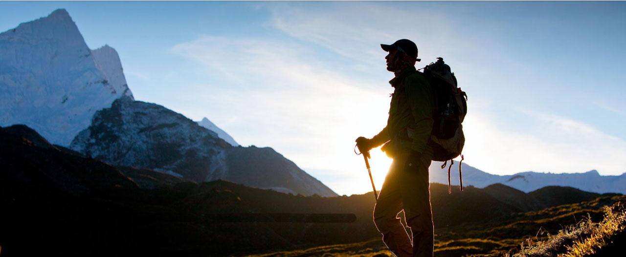
The Hampta Pass Trek is one of the most delightful treks in the Manali region of Himachal Pradesh. Hampta Pass Trek is a moderate trek with a scope for varying the duration to suit ones time. The beauty of this trek is everyday the landscape changes. You start the trek in thick forest and then enter in open valleys with lush green cover of grass then the tree line stops and you cross to Hampta Pass and enter the barren landscape of Lahaul & Spiti and visit to Chandratal lake is icing on the cake. Hampta Pass Trek takes us over the majestic foothills of the Himalayas, the Pir Panjal Range, crossing at Hampta Pass (4270 mts..)
Hampta Pass trek is known for its higher grasslands, which the trekkers would eventually cross on their journey up to the highest point. Sometimes, these patches of open land are used as campsites as well. These meadows are visited by shepherds from the foothill regions during the summer months when the cold, deserts of Lahaul Valley are left too barren for the cattle to graze. The locals also believe that a certain kind of grass that grows in this region, which they call ‘Neeru’, is a great source of nutrition for the herds and therefore a good feed.
Name of the Trek : Hamta Pass with Chandertal Trek
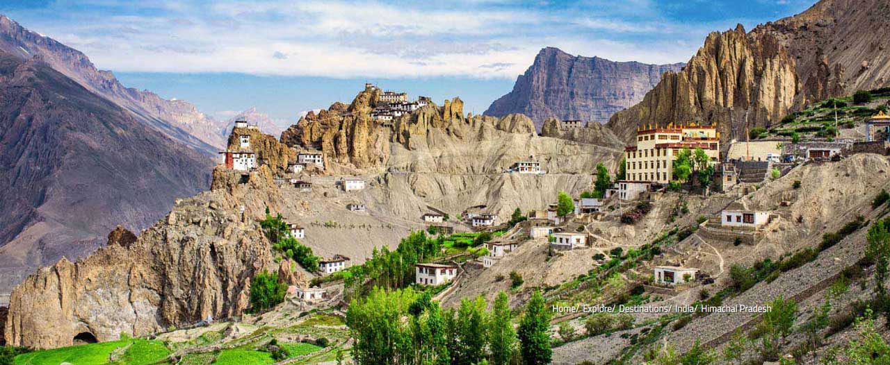
Sector : Manali, Himachal Pradesh
Trekking Grade : Moderate
Highest Altitude : 4270 mts.(Hamta Pass)
Best Season : Mid June, September - October
Duration of the Tour : 07 days
Duration of the Trek : 06 days
Outline Itinerary :
Day 01) Manali to Chikka via Jobra (3270mts.) / 05-06 hrs trek/ o/n Camp
Day 02) Chika to Balu ka Gera(3700mts) / 04-05 hrs trek / o/n Camp
Day 03) Balu-Ka-Gera to Shea Goru(3750mts.) crossing Hampta Pass / 06-07 hrs trek/ o//n camp
Day 04) Shea Goru - Chhota Dhara (3740 mts) / 07 hrs. Trek / o/n Camp
Day 05) Chhota Dara - Batal (3960mts.) / 06 hrs. Trek/ o/n Camp
Day 06) Batal- Chandra Tal (4270mts.) / 5-6 hrs Trek/ o/n Camp
Day 07) Chander Tal – Manali Drive / 07 hrs drive
RATES
|
Category
|
Hotels |
Min 02 Pax |
Min 04 Pax |
Min 06 Pax |
|
Standard
|
Rs. |
Rs. |
Rs. |
|
|
Deluxe
|
Rs. |
Rs. |
Rs. |
- Above rates are based on per person basis
- Accommodation in alpine/Dom tents while camping on Double sharing basis
- All Breakfast, Lunch and Dinner during trekking. Breakfast & dinner would be hot and lunches would be packed during the trek
- Local Accompanying English speaking Trekking guide
- Cook & Helper during the trekking
- Insulation mats for trekking style camping (Clients are requested to bring their own sleeping bags)
- Dinning tent(if above 04 pax)
- Kitchen tent fitted with kitchen equipment
- Ponies/Porters during trekking to carry baggage, food material, camping equipment
- Accommodation in mentioned or similar category hotels on double/twin sharing basis
- All breakfasts and Dinners in the Hotels
- All transport by air conditioned Vehicle (02-03 Pax in Toyota Etios Car, 04-06 in Toyota Innova) as required in the tour programme
- All Toll taxes, parking fee, state taxes and drivers allowances
QUOTATION EXCLUDES:
- Airfare/Train fare/Bus fare
- Sleeping bags, Trekking Shoes and clothing
- Any other meals
- Any expenditure of personal nature such as telephone calls, laundry, mini bar or drinks during meals, tips to driver, guide, helper, etc.
- Any kind of Insurance and medical evacuation
- Any Hotel before starts and after tour ends
- Guides and Monuments Fees
- All other than those listed in inclusive
- GST
We can provide you all other travel services before tour starts and ends
Detail Itinerary :
Day 01) Manali to Chika via Jobra (3270mts.) / 05-06 hrs trek
The trekking expedition starts from Manali to Jobra in vehicle. Manali is already at an elevation of 6, 726 ft above sea level. So, it is a good place to acclimatize your body before beginning the trek. It takes an hour and forty hairpin bends to arrive at Jobra. All the necessary items required for the trek like ration, kerosene, medicines and other travel equipments is available in Jobra. Jobra is at an altitude of 9, 800 ft. On the first day you will reach a height of 10, 400 ft and cover up two to three hours of trek.
The trek on foot initiates from Allain Guhugal Hydel Project junction. After crossing the main road, take the small path that leads to the forest of pine trees. You will also find other variety of trees like maple, deodar, toss and oak. The sight is refreshing. The slope that is supposed to be climbed is an easy one and not very steep. Twenty minutes into the trek, you will reach a bend that overlooks a lush green meadow strewed with small rocks. Enjoy the surrounding for a couple of minutes and head towards the meadow. The Rani nallah comes into view which flows directly in between the meadow. You will also see few sheep and cows grazing in the field. The sight looks exactly as if taken out from fairy tale. You can pass through the meadow or climb up the hill on the left hand side. Either way you will reach Chika which is at the end of the vast meadow. But, climbing the hill and descending down to Chika is a better and easier route. Chika camp site is a huge, spacious patch of green. The Rani River flowing in the middle makes this place perfect for setting up the tents.
Overnight stay in Camps.
Day 02) Chika to Balu ka Gera(3700mts) / 04-05 hrs trek
The next destination is Balu ka Gera which is not visible from the Chika camp site, but you can make an idea as it falls to the right. Follow the left bank of the river that will appear at your right hand side. The trail leads the way to a slope of boulders and rough terrain. The path is an easy one and can be accomplished without any difficulty. You will find an entire stretch of the river's right bank lined up with amazing dwarf Rhododendron trees. These trees will cover the lower and the central region and cluster of silver birch trees cover up the upper region. Once you have reached the end of silver birch trees, wait a moment and look back to marvel the entire range of Dhauladhar snow clad peaks in front of you. The view is very picturesque. You will reach a clear stream waterfall to the left at a distant. Best place to fill in your bottles.
After crossing the waterfall, the next route is towards the river to your left. You can go to the other side only by crossing the rivulet by wetting your feet. The water is super cold and will definitely prick your feet. You can also jump from one rock to another in the stream and get to the opposite side. You must have finished half of the day's trek when you enter Jwara. Jwara is a beautiful scenic sheltered valley; huge snow clad rocks at one side and the valley drops down to the river on the other side. You will feel like immersing yourself in the beauty of God's nature. You will find snows melting into the river and cattle grazing the land. In front of the picture is snow clad mountains and behind them lies the Hampta Pass. From here, the trail would be by the river side which will lead you to another rectangular valley. The path is covered with multi colored flowers. The last of the tree lines vanishes out of the sight and is left behind. It will take another half an hour or so to reach the end of the valley, which is the finishing part of Jwara. After Jwara, the path is a slope covered with snows and rocks. The end of the path is Balu ka Gera, the name has nothing to do with the place. The place is covered with snow and greens whereas the name imply mound of sand. But it is said that this place was formed with the sands and dust deposited by the river. Balu ka Gera campsite is a flat ground amidst the mountains that you will cross the next day to reach the pass. Balu ka Gera is at an elevation of 11, 900 ft.
Overnight stay in Camps.
Day 03) Balu-Ka-Gera to Shea Goru(3750mts.) crossing Hampta Pass(4270 Mts.) / 06-07 hrs trek
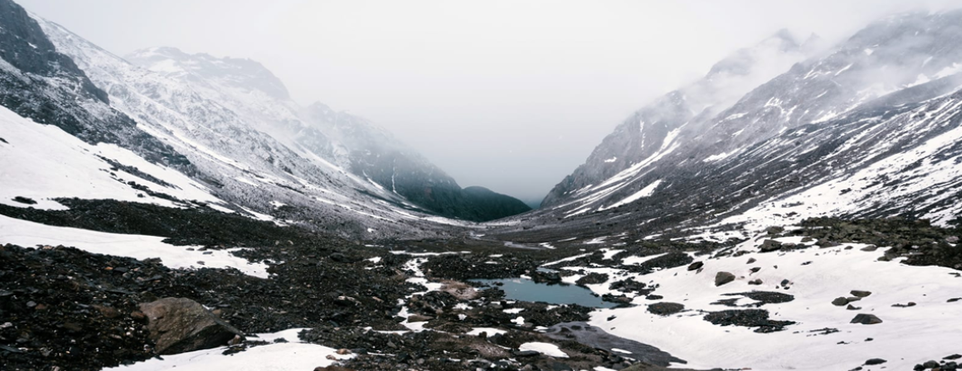
The day's trek encompasses 8 hours. You can split the journey in two halves, a steady ascent on moderate steep slope to Hampta Pass, thence a sharp descent to Sia Goru. The highest altitude will be achieved on this day at Hampta Pass (14, 100 ft). The day starts by heading towards the mountains you spotted the previous day. The trail is along the river side. The view is amazing, tiny yellow and orange flowers give a pleasant picture to the river. The river side trails takes you further to the base and then the actual climb to the Hampta pass takes place. It will take an hour to reach here. Another hour of walk will take you to the first plateau. In summer, the place is completely covered with thick fresh snow. Otherwise, it is just patches of snow everywhere. The Deo Tibet peak will fall right in front of you.
You will reach another plateau and then to a ridge. It will take another half an hour to reach the ridge's end. Then from the first ridge trek further up to get on the second ridge. Hampta Pass is just a few meters and a bend away from the second ridge. The climb to Hampta Pass is a vertical one and is a hard mount. It will take about 15 minutes to reach the pass. Yes, by the time you reach there, you would be extremely tired but the site which enfolds in front of you is stunning. Enjoy for sometime in the pass, relish the beauty around, have your lunch and then get ready for the next descent to Sia Goru.
The descent is trickier than the journey to the pass. The decline is so steep that you would not be able to locate the base of the mountain, not even by craning your neck. The best possible way to get down is either by sliding down the slope or with the use of ropes for support. The route is a little meandering too. You will also spot Spiti from this point. In an hour and a half you will reach the base of the valley that will lead you to Sia Goru. The valley is secured by snow clad mountains, and the side which is open is Sia goru's way. The trek to Sheagoru is easy on flat land.
The Shea Goru camp site is also by the river side. Set your camps on the grounds and retire for the night with a feeling of contentment at the heart.
Overnight stay in Camps.
Day 04) Shea Goru - Chhota Dhara (3740 mts) / 07 hrs. Trek
an early morning steam crossing ,through the stream is very less in the month of the order of the day before following the valley down on the true right through the boulder field to your first views of the Chandra valley. Then trail winds through a narrow valley along the roadside. The terrain becomes more rugged and the colors more spectacular. All along the trail(which is actually an non metalled road ).
Overnight stay in Camps.
Day 05) Chhota Dara - Batal (3960mts.) / 06 hrs. Trek
today the same trail along the river Chandra on the non metalloid leads to tiny hamlet of Batal. From here there is a bifurcation. One road leads over the Kunzum-la in to the Spitil valley ,while the other one goes on towards enchanting lake of the moon (Chandrataal) on the way glimpses of the bara shigri glacier provide one with the enormous scales that the western Himalayan glaciers are made of this particular glacier extends over 12km. camp at Batal.
Overnight stay in Camps.
Day 06) Batal- Chandra Tal (4270mts.) / 5-6 hrs Trek
The trail to Chandra tal cuts away from the river valley and gradually ascends. Through boulder fields fields at first, before meeting the stream coming from the lake. From here on. The trail cecomes steeper. Passing over grassy ridges towards a fertile plateau, which acts as a divide between the main Chandra velley and the side valley fed by the streem from Chandra Tal .An excellent campsite and a relaxed evening after the rewading walk form Batal.
Overnight stay in Camps.
Day 07) Chander Tal – Manali Drive / 07 hrs drive
Drive back to Manali
Tour Ends But Memories Remains – Always


 Powered by Shimla Helpline